Whangarei
17.89°C

Whangarei
17.89°C
Waitakere City
16.98°C
Manukau City
17.11°C

Papakura
24.46°C
Hauraki
17.26°C

Waikato
17.67°C
Matamata
18.46°C
Hamilton
17.51°C
Otorohanga
18.52°C
Rotorua
16.6°C
Taupo
15.44°C
Tauranga
19.27°C
Kawerau
18.6°C
Whakatane
19.64°C
Gisborne
15.51°C
New Plymouth
16.98°C

Stratford
8.97°C
Ruapehu
14°C
Wanganui
17°C
Palmerston North
16.41°C
Wairoa
19.19°C
Hastings
18.84°C
Napier
18.49°C
Masterton
15.49°C
Carterton
15.66°C
Porirua
15.99°C
Lower Hutt
16.45°C

Wellington
15.79°C

Tasman
9.35°C
Nelson
16.27°C
Marlborough
3.22°C
Kaikoura
15.48°C
Christchurch
12.59°C
Ashburton
12.52°C
Timaru
13.37°C
Waitaki
11.32°C
Waimate
13.08°C

Queenstown
12.38°C
Dunedin
14.33°C
Southland
9.98°C
Gore
11.31°C
Invercargill
12.06°C
Blenheim
14.73°C
Te Anau
27.35°C
Wanaka
11.17°C
Kaikoura
13.38°C
Stratford
13.54°C
Upper Hutt
15.9°C
About


The Trail runs south along the stopbank from Ruawai Wharf for 4km to the end of Simpson Road. It is suitable for all ages and abilities. The ride offers views of the Kaipara Harbour and access to a very special wide-open space.
Cyclists may choose to loop around Wilson’s Landing Road or continue along Simpsons Road for a longer ride, either to Tinopai or the café at Matakohe Museum. The Ruawai Flats were once a tidal swamp and over the past 100 years a man-made system of drains, floodgates and stopbanks have transformed it into some of the most fertile and productive kumara and dairy farmland in Northland.
See the floodgates operating, learn about the history of the area from informative signs and observe the wildlife as you ride. Facilities – there are parking, toilets and drinking fountain at the Ruawai Wharf and a Café in Ruawai township.
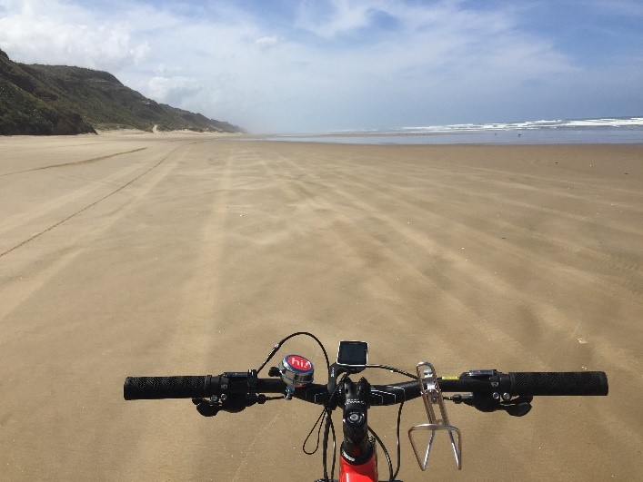
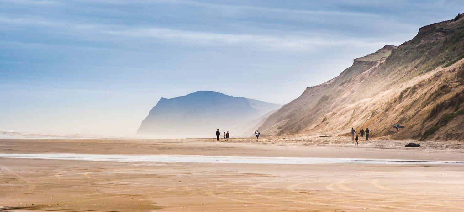
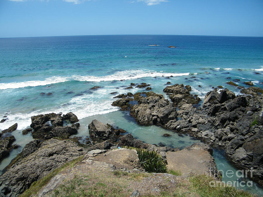
Ripiro beach is 107 km long and is New Zealand’s longest driveable beach, longer than the erroneously named Ninety Mile Beach. Baylys Beach is home to the famous local shellfish delicacy called the Toheroa, which was overfished in the 1960’s and 70’s and as a result, public gathering of the shellfish is now prohibited. You may however, find some tuatua’s. As the sands move over time pre-historic embedded kauri logs up to 50,000 years old are often exposed. Historically the wreck of the Alcemene was found here, a three-masted French warship that sank here in 1815.
Start from either Baylys Beach or Glinks Gully entrances where there are toilets, parking and vehicle access to the beach.
The beach is rideable 2 ½ hours either side of low tide (check Pouto tides) as the low tide exposes the hard sand. Ride as far as you like in either direction - we suggest riding into the wind first so you have an easy return trip.
Facilities – toilets, parking, Sharky’s Café and Takeaways at Baylys Beach.
New Zealand is renowned for its breathtaking natural landscapes, and Lake Kai Iwi, nestled near Whanganui in the North Island, is no exception. This hidden gem offers a serene escape into the heart of nature, with a network of captivating trails that cater to outdoor enthusiasts of all levels. If you're seeking tranquility and adventure intertwined with lush greenery and the serenity of water, Lake Kai Iwi's trails are your perfect destination.Lake Kai Iwi's trails offer an opportunity to reconnect with nature, recharge your spirit, and embrace the beauty of New Zealand's outdoors. Whether you're a hiker, cyclist, angler, or someone simply.
Lake Kai Iwi is a natural sanctuary that invites you to reconnect with the great outdoors. It offers a diverse range of experiences, from tranquil moments by the lake to exhilarating adventures on the trails. Whether you're seeking solitude, quality time with loved ones, or a taste of New Zealand's pristine wilderness, Lake Kai Iwi promises an unforgettable journey into the heart of nature. Visit and discover the beauty that awaits in this unspoiled paradise.
Kaipara Harbour is a large enclosed harbour estuary complex on the north western side of the North Island of New Zealand. The northern part of the harbour is administered by the Kaipara District and the southern part is administered by the Auckland Council.
By area, the Kaipara Harbour is one of the largest harbours in the world. It covers 947 square kilometres (366 sq mi) at high tide, with 409 square kilometres (158 sq mi) exposed as mudflats and sandflats at low tide.
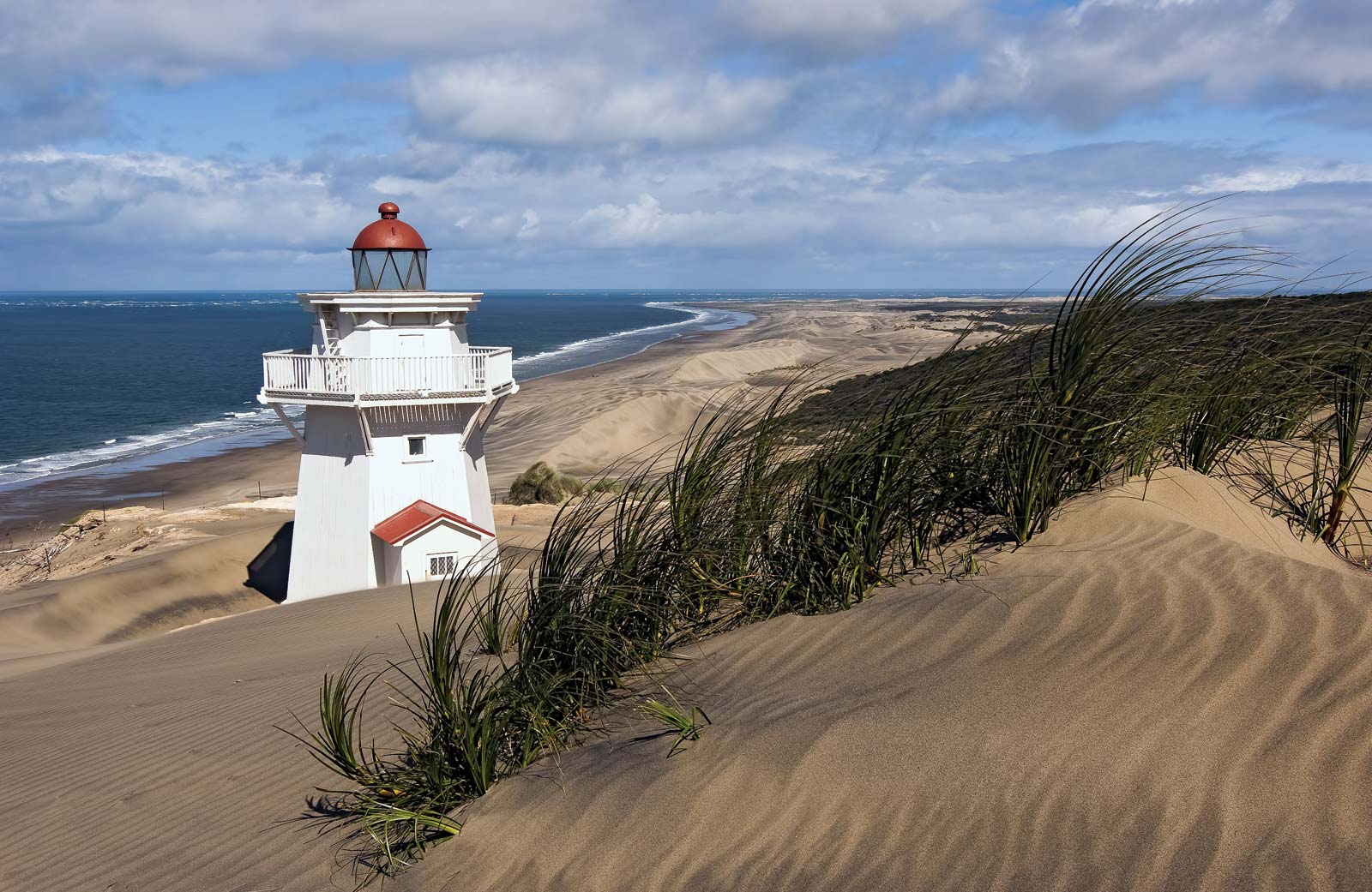
These treacherous sandbanks shift and change position, and are known locally as the graveyard. The graveyard is responsible for more shipwrecks than any other place in New Zealand, and has claimed at least 43 vessels—some say as many as 110. For this reason, a lighthouse was built in 1884 on the northern arm of the entrance (Puoto Peninsula). It was automated in 1947 and closed in the mid 1950s. The structure still exists and was renovated in 1982–84.
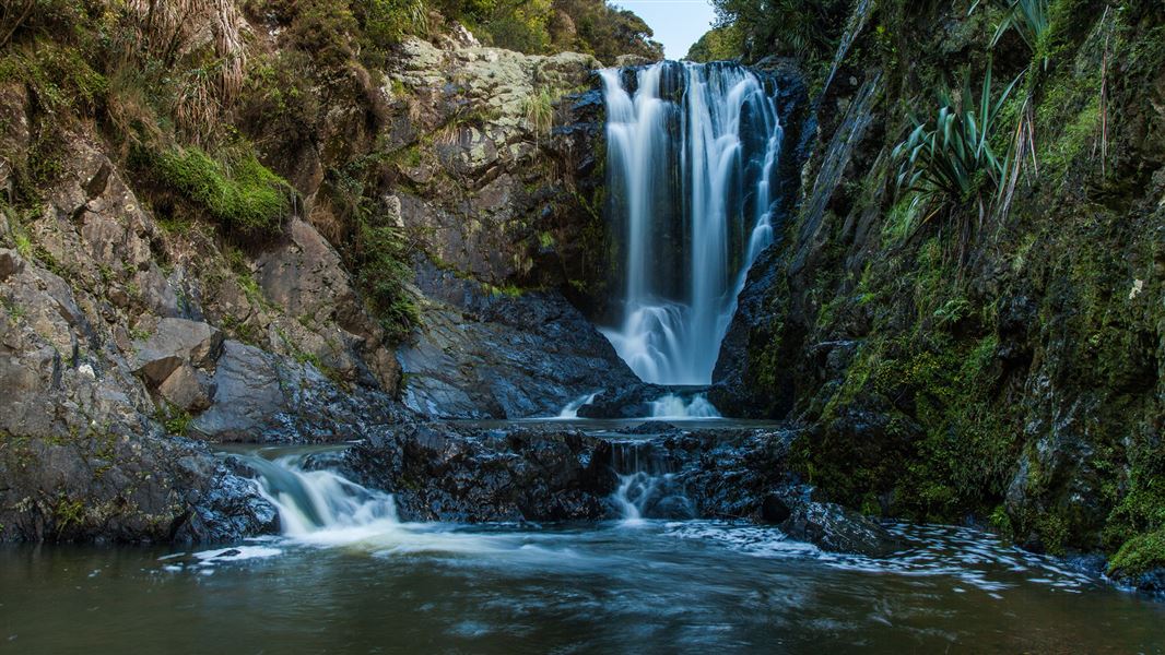
Follow a 200 m track across the Ahuroa River and on to the picturesque Piroa Falls.
The track descends briefly down through bush into the gorge, there are a number of steps. You cross the Ahuroa River on a concrete slab bridge with 'Rotary 1983' engraved on it (the track was built and upgraded courtesy of Maungaturoto Rotary Club). A minute or two after crossing the bridge you arrive at the base of the picturesque Piroa Falls.
Piroa Falls is located in the Waipu Gorge Scenic Reserve, signposted on SH1 at the foot of the northern side of the Brynderwyn Hills. Follow Waipu Gorge Road for about 6 km until you reach the car park and track indicated by a DOC sign. Parking is limited on the narrow unsealed road, care should be taken here.
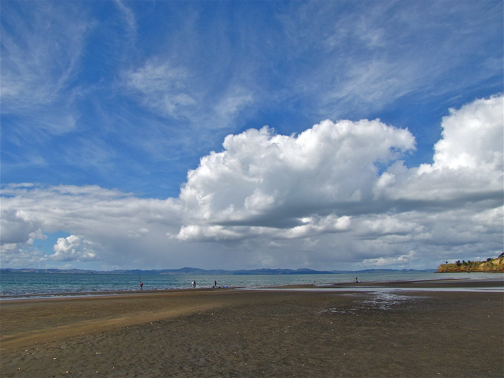
Te Arai offers pristine white sandy beaches at the end of picturesque rural roads and a glorious campground within the regional park.
It's an area well known by surfers for consistent and safe conditions and it's an utterly gorgeous spot for a day at the beach.
From SH1 in Wellsford, take Matheson Road at the top of the hill as you leave the shops behind. It's signposted to Whangaripo Valley, Pakiri and Tomarata. Continue on Matheson as it becomes Whangaripo Valley Road, then take Waiteitei Road to your left, signposted to Mangawhai.
At the end of Waiteitei Road, turn right into Mangawhai Road for 3.6kms then take Te Arai Point Road to your right and travel to the end. Much of Te Arai Point Road is gravel, so drive with care. A brief walk to the top of the point will give you views right along the beach and you can choose from swimming in the surf or at the sheltered old quarry swimming hole. Make sure you explore the beaches on either side of Te Arai Point as well because Forestry and Black Swamp are even more beautiful.
The area is home to several species of bird and plant whose existence hangs in the balance, including the New Zealand Fairy Tern and the Northern New Zealand Dotterel. It's crucial for them that you take only photographs and leave only footprints… do not disturb them and let nothing harm them. Dogs are not allowed at Te Arai.
Mosquito Bay is very much part of the Kaipara system, at the tip of the southern sandbar that encloses and shelters the Kawau Parua Inlet. As it turns out, the sandbar is not a sandbar but a delta, the geological differences being quite important, as the future changes to the area depend on the way in which the formation is taking place. GeoTrips gives a very good explanation.
The short version is that the lovely sand and interesting sedimentary rocks here have drifted all the way from the ancient Taranaki Volcanoes, creating what is known as a 'flood tide delta'. Over the last million or two years. The flat floor of the harbour here is from older Kaipara Volcanoes. And the happy result is the fishing is reportedly marvellous, there are snapper galore and some fish can be caught by surfcasting. Be aware there have been many shipwrecks on the Kaipara Bar.
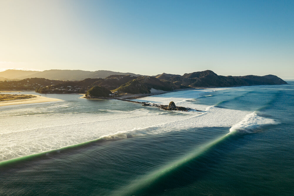
Mangawhai, also known as Mangawhai Heads, is nestled between the Pacific coast and rolling farmland. You’re offered a choice of seaside experiences here – a surf beach on one side and safe harbour beaches on the other.
On the far side of the harbour is a large sand dune area that's administered by the Department of Conservation. The dunes are home to fairy terns, Caspian terns, variable oystercatchers and New Zealand dotterels. Mangawhai Heads and the village of Mangawhai are linked by a picturesque causeway surrounded by native wetlands and bush.
Mangawhai offers a range of activities including water-sports, a world-class 18-hole championship golf course, wineries, Bennetts Chocolate factory, and a fabulous museum that tells the amazing history of the region.
Charter boats are available to take you fishing or diving; you can also surf cast off the beach. Other local activities include donkey rides and mini-golf.
This walk provides breathtaking coastal views that extend from Bream Head in the north down to the Tāwharanui Peninsula in the south. The Coromandel Peninsula and Great Barrier Island/Aotea are often seen on the horizon. The track starts along the beach, then climbs quite steeply for about 20 minutes to a lookout point. It then winds past ancient pōhutukawa teetering on the sheer slopes before descending to the stony beach below. From here you can walk back along the beach (8 km), but only at low tide. Keep to the marked track as it crosses private property.
Mangawhai is 25 km from Waipu to the north and 26 km from Wellsford to the south. Access to the track is from the Kaipara District Council car park near the Mangawhai Surf Life Saving Club at the end of Wintle Street.
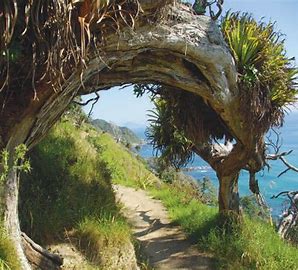
You may see New Zealand pigeon/kererū/kūkupa or kākā making an occasional visit from the offshore islands. Local iwi call the New Zealand pigeon/kererū the kūkupa. Pōhutukawa and nīkau palms feature on this walk. Interesting rock formations and geology can be seen exposed along the rocky coastal section.
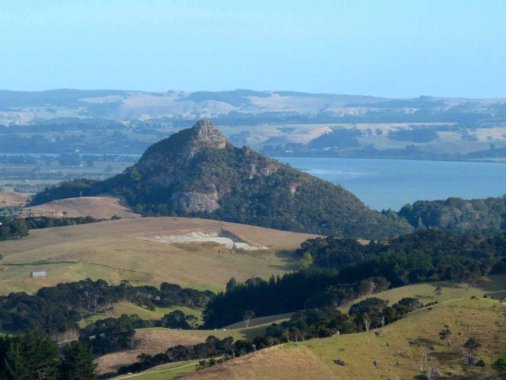
The track climbs steadily to the top of Tokatoka, a very distinctive landmark in the Kaipara district. Note, there is a particularly steep 20 m section near the top. From the top, the 360-degree views are stunning. You'll get great views towards Dargaville and of the Kaipara. On a clear day, you're able to see Bream Head and the Tangihua range towards the east. This is a very exposed area; with a steep ascent over rocks. Take extreme caution at the top as the drop off is steep and there are no handrails, especially if you suffer from vertigo or are scared of heights. Supervise children at all times. The track becomes very slippery after rain. Take extreme care.
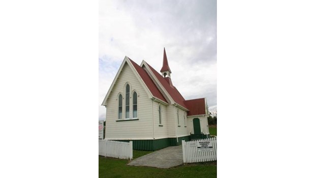
Whakapirau, a charming seaside village on the shores of the Kaipara Harbour, is home to St Alban’s Anglican Church. Well-loved in the district this historical icon was built in the late 1890s by local builder, Frank Somner, for the princely sum of 500 pounds ($1,000).
With Chadwick’s mill just down the road beside the present wharf Mr Somner was able to use top quality kauri timber both inside and out and, although the mill is long gone, burnt down in 1906, the church still stands proudly on top of the hill at the entry to the village.
Built to the classic cruciform design St Alban’s is a graceful example of pioneering architecture and enjoys a Category 2 Heritage NZ classification. Frank Somner was clearly a master of his trade and the quality of his workmanship is still very evident today.
The church opened its doors in 1896 to the 150 hardy locals who had braved the cold and the mud to be St Alban’s first congregation. These were folk who had worked long and hard to fund this project. They had done everything from holding flower shows to selling hot water for pots of tea at the Pahi Regattas to raise the money required and were justifiably proud of the result. The church, with its interior of beautiful golden heart kauri, was resplendent with curtains of red velvet and gold braid. While the altar was graced by gleaming brass candle sticks and vases sent out from England by absent relatives. Over the following decades St Alban’s has been maintained by the local congregation and owes its present well preserved state to their efforts.
Under the administration of the Anglican Diocese of Auckland St. Albans holds a 10am Service on the third Sunday of every month conducted by the newly appointed Priest in charge Reverend Colleen Binns.
A warm invitation is extended to all to share our informal gathering in our historic Church at the northern end of the Kaipara Harbour in the charming harbour side village of Whakapirau.
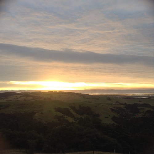
Walk to the summit of Mount Auckland (Atuanui) through regenerating native forest, with spectacular views over the nearby Kaipara Harbour and Hoteo River estuary.
The walkway follows an airstrip and logging track along the ridge to the Atuanui forest, which has fine stands of regenerating rimu and kauri. It continues up a narrow ridge with side tracks to view mature kauri.
A lookout at the summit (305 metres) provides panoramic views. From here you can retrace your steps or take the track westward to the Kaipara Coast Highway exit, which is a steeper descent. This end of the track exits through farm land to SH 16.