Whangarei
17.89°C

Whangarei
17.89°C
Waitakere City
16.98°C
Manukau City
17.11°C

Papakura
24.46°C
Hauraki
17.26°C

Waikato
17.67°C
Matamata
18.46°C
Hamilton
17.51°C
Otorohanga
18.52°C
Rotorua
16.6°C
Taupo
15.44°C
Tauranga
19.27°C
Kawerau
18.6°C
Whakatane
19.64°C
Gisborne
15.51°C
New Plymouth
16.98°C

Stratford
8.97°C
Ruapehu
14°C
Wanganui
17°C
Palmerston North
16.41°C
Wairoa
19.19°C
Hastings
18.84°C
Napier
18.49°C
Masterton
15.49°C
Carterton
15.66°C
Porirua
15.99°C
Lower Hutt
16.45°C

Wellington
15.79°C

Tasman
9.35°C
Nelson
16.27°C
Marlborough
3.22°C
Kaikoura
15.48°C
Christchurch
12.59°C
Ashburton
12.52°C
Timaru
13.37°C
Waitaki
11.32°C
Waimate
13.08°C

Queenstown
12.38°C
Dunedin
14.33°C
Southland
9.98°C
Gore
11.31°C
Invercargill
12.06°C
Blenheim
14.73°C
Te Anau
27.35°C
Wanaka
11.17°C
Kaikoura
13.38°C
Stratford
13.54°C
Upper Hutt
15.9°C
About


The Remutaka Cycle Trail’s four sections can be completed pleasurably in 2–3 days. Petone is the natural starting point, although Maymorn in Upper Hutt and Featherston in the Wairarapa are also popular. All can be reached on the Wellington to Wairarapa train service that stops at various other stations close the trail.
Shuttle pick-ups are available from the Orongorongo end, but it is also possible to close the loop with some extra riding.
Petone—Maymorn
35km, Grade 2/easy, 3–5 hours
The trail starts on Petone Foreshore, a significant settlement site of both Māori and Pākehā peoples, and home to the neat little Settlers Museum that will inform your onward journey. A short detour one block inland, historic Jackson Street has stacks of interesting cafes and delis, and is therefore a good place to stock up on supplies.
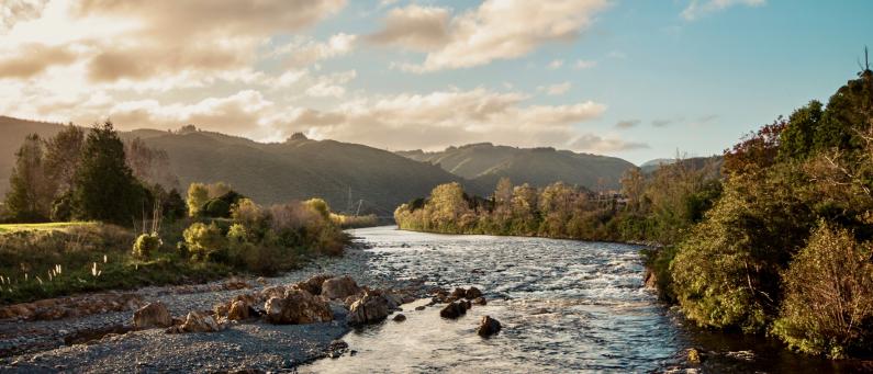
Having skirted the foreshore, the trail winds along the Hutt River Trail, a wide and largely flat pathway offering open views of the valley as you progress.
Referred to as Wellington’s ‘big backyard’, the Hutt’s bush-clad hills and expansive green spaces offer recreation aplenty for local and visitor alike. Riverside reserves, parks and playgrounds may well beckon you off the bike, as may major Hutt Valley attractions a short detour off the trail, including Lower Hutt city’s Dowse Art Museum & Brewtown in Upper Hutt.
Beyond Upper Hutt city in the foothills of the Remutaka Ranges, the leafy suburb of Maymorn is the end of this section and the start of something wild.
Maymorn—Cross Creek
25km, Grade 2–3/easy–intermediate, 3–4 hours
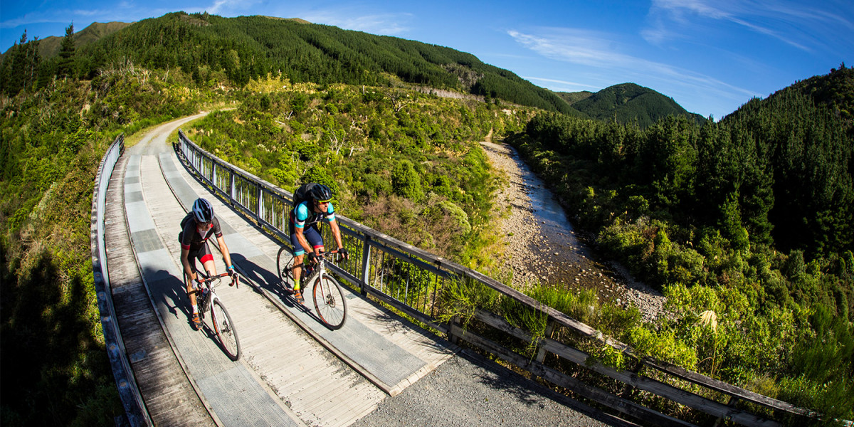
It’s a short ride from the streets of Maymorn to Tunnel Gully Recreation Area, where riders leave suburbia and head through a series of bushy trails, quiet roads and the historic 221m Maymorn tunnel to reach the historic Remutaka Rail Trail – a highlight of the entire cycle trail and an ever-popular day ride for locals. Bring a torch for the various tunnels en route.
Tracing the old railway, this lovely trail winds gently up through a mix of exotic and regenerating forest, with storyboards pinpointing railway relics and retelling colourful tales. The gentle climb finishes at ‘Summit’, a pretty recreation area with shelter and toilets, and therefore the perfect spot for a rest.
Just beyond Summit is a particularly impressive 584m-long tunnel, followed by a platform with views of the valley leading down to the Wairarapa Plains.
The trail is narrower and a bit more rugged on this side, and has a few more tunnels. It also now boasts a rather photogenic 90m swing bridge over Siberia Gully, the site of a tragedy in 1880 when a train was literally blown off the tracks. In high winds, riders can dismount and use the alternative trail route avoiding the Siberia swing bridge.
Views of expansive Wairarapa Moana (Lake Wairarapa) open up as riders emerge from the Remutaka Ranges at Cross Creek. Allow time to wander around the site of the old railway settlement before hitting the last little stretch of singletrack.
The Cross Creek car park is the logical pick-up point if you’re detouring into wine country for a day or two; Martinborough is less than 30 minutes’ drive away.
From Cross Creek, it’s also just 10km to Featherston where there’s accommodation along with several places to eat and some neat little shops. You can also catch a train back to Wellington from there.
Cross Creek—Ocean Beach
36km, Grade 3/intermediate, 2–3 hours
This mainly on-road section of trail takes riders through quiet farm country, along the shores of Lake Wairarapa and Lake Onoke to reach the shores of Palliser Bay. Lush pasture stretches out to the water’s edge. Shorebirds peck at paddocks. Sheep snuggle close in their flocks. Wind-bitten trees, including lone tī kōuka (Cabbage Tree), add striking silhouettes to the scene.
A handful of accommodation options are not only a good place to break the multi-day journey, but also offer a chance to dig down into the area’s fascinating history. Some of New Zealand’s earliest sheep stations were established around here; the cottage accommodation at historic Wairongomai Homestead offers window into this past.
This stretch is also a treat for bird-lovers, with the lakes, wetlands and ocean supporting populations of more than one hundred species, including rare ones such as Caspian Tern and Banded Dotterel. It’s worth considering a walk on to Onoke Spit, which you pass along the trail. But if you want to see more birds and learn more about them, check out Te Rakau Birding & Cabins who offer accommodation and tours.
Whether you’ve stayed overnight around here, or detoured into Wairarapa wine country, the next leg of the Remutaka Cycle Trail starts in earnest at Ocean Beach, a rugged stretch of shingle on the edge of the Cook Strait.
Be sure to check the forecast before you start prepping for the next section. From here things can get pretty wild.
Ocean Beach—Orongorongo River
18km, Grade 3–4/ intermediate–advanced, 3–4 hours
The last section of trail is arguably the most scenic. But it’s also the most challenging, being fully exposed to southerlies whipping off the ocean, and northerlies barreling over hilltops and funneling down gullies. What’s more, heavy rains in previous days can make some streams impassable. The trail surface is often rocky and sandy. There are no shops or services, and virtually no cellphone coverage. Check the forecast and current trail conditions, make sure your bike is in good order, and pack food and clothing for all eventualities.
On a good day, you’ll wonder what all the fuss is about. Stark and rugged this place may be, but it is truly a sight to behold with its mountains plunging dramatically into the ocean.
Indeed, this coastline is riven with geological oddities, created by immense geological forces that raise the beaches out of the water with every big quake. Big weather, meanwhile, breaks the landmass down into rocks and scree. The largest rockslide you come across is named the Kotumu Fan – you’ll know it when you see it!
There’s plenty more to see along the way, from horses, birds and weird, windswept vegetation, to long-range views of South Island’s Kaikoura Ranges.
The southernmost point of the trail is Turakirae Head, home to hundreds of kekeno (NZ fur seals). (Please respect them by keeping at least 20m away.)
The trail ends at the Orongorongo River mouth, where a pre-booked shuttle can take the sting out of the 30km road-ride back to Petone.
The Cannon Point and Birchville Dam walk is a 90-minute intermediate level trail through the hills north of Upper Hutt.
It is 8km long and passes through both private land and Greater Wellington's Akatarawa Forest. The trail starts from Tulsa Park and zigzags uphill through private land and Akatarawa Forest to the summit, where you'll find spectacular views over the Hutt Valley. It then continues along old forestry roads to the north and descends to the historic Birchville Dam.
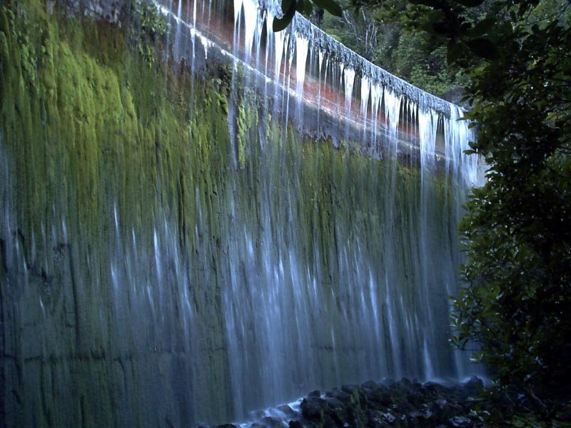
The dam, built in 1929, supplied water to Upper Hutt until the Kaitoke Scheme started in 1954. From here, you'll continue 1 km downstream and over a suspension bridge to the end of the trail.
You can choose to start or finish the trail from Tulsa Park or Bridge Street in Upper Hutt:
Tulsa Park
Take State Highway 2 to Upper Hutt, then turn onto Totara Park Road and continue to the end of the street.
Bridge Road
Take State Highway 2 to Brown Owl, Upper Hutt. Turn onto Akatarawa Road and continue until you see the signpost for Bridge Road. The car park is located about halfway along Bridge Road.