Whangarei
17.89°C

Whangarei
17.89°C
Waitakere City
16.98°C
Manukau City
17.11°C

Papakura
24.46°C
Hauraki
17.26°C

Waikato
17.67°C
Matamata
18.46°C
Hamilton
17.51°C
Otorohanga
18.52°C
Rotorua
16.6°C
Taupo
15.44°C
Tauranga
19.27°C
Kawerau
18.6°C
Whakatane
19.64°C
Gisborne
15.51°C
New Plymouth
16.98°C

Stratford
8.97°C
Ruapehu
14°C
Wanganui
17°C
Palmerston North
16.41°C
Wairoa
19.19°C
Hastings
18.84°C
Napier
18.49°C
Masterton
15.49°C
Carterton
15.66°C
Porirua
15.99°C
Lower Hutt
16.45°C

Wellington
15.79°C

Tasman
9.35°C
Nelson
16.27°C
Marlborough
3.22°C
Kaikoura
15.48°C
Christchurch
12.59°C
Ashburton
12.52°C
Timaru
13.37°C
Waitaki
11.32°C
Waimate
13.08°C

Queenstown
12.38°C
Dunedin
14.33°C
Southland
9.98°C
Gore
11.31°C
Invercargill
12.06°C
Blenheim
14.73°C
Te Anau
27.35°C
Wanaka
11.17°C
Kaikoura
13.38°C
Stratford
13.54°C
Upper Hutt
15.9°C
About


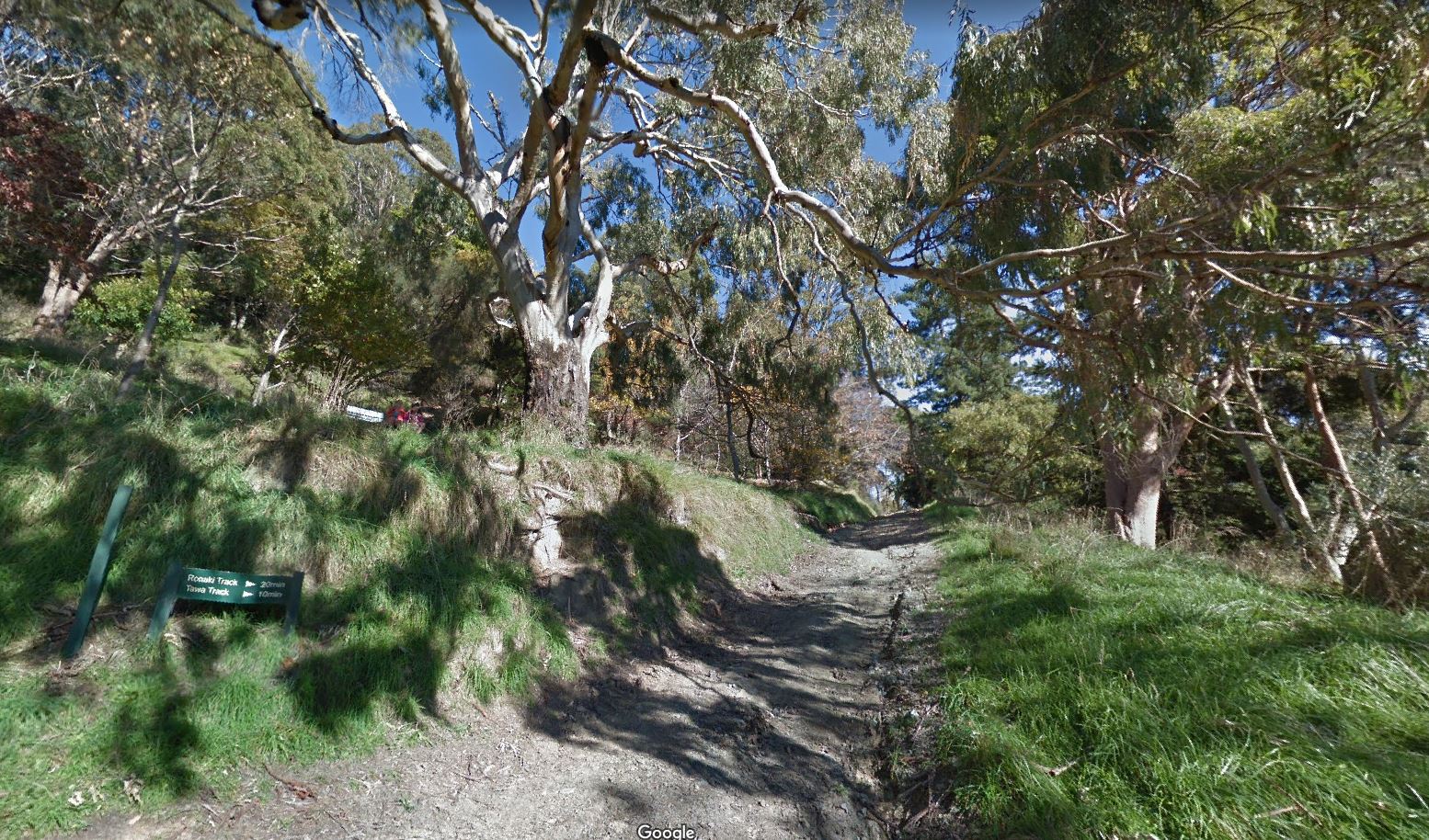
The Centre of New Zealand on Botanical Hill is one of Nelson’s most popular walks. The starting point is the Botanical Reserve, over a footbridge from the end of Hardy Street, or you can start at the Nelson Visitor Information Centre and follow the Maitai Walkway to the Hardy Street footbridge. Take a look at the interpretive panel at the bottom of the hill for some views of Nelson over the last century, and the history of this ‘Village Green’.
To reach the Centre of New Zealand will take 20-60 minutes, depending on your age, speed and fitness. The main track is suitable for sturdier push chairs and buggies. At the top take a seat, enjoy the stunning view and pick out the features of Nelson’s geography from the information panels.You can go downhill on one of the other tracks on the Botanical Hill, or opt to head along the hillside to Walters Bluff. A good summer option is to take your togs, walk down the eastern side of the hill to Branford Park, have a swim at Black Hole and take the Maitai Track back to your starting point.
The name reflects the work of John Spence Browning the Chief Surveyor for Nelson in the 1870's. He used the top of the hill as a central survey point for doing the first geodetic survey of New Zealand when earlier isolated surveys where combined. A survey in 1962 located the centre of New Zealand at 41deg. 30min S., 172deg. 50min E., which is a point in the Spooners Range in the Golden Downs Forest. The survey did not include the Chathams.
In the early days of European settlement in New Zealand, independent surveyors made isolated surveys that were not connected up. In the 1870s, it was decided to connect these up by a geodetic survey (one that takes into account the curvature of the earth) and John Spence Browning, the Chief Surveyor for Nelson was the only surveyor with the practical experience to do the job. Because he was located in Nelson he was instructed to begin the job here and to extend the survey south to the West Coast.
Later it was connected up to surveys from Canterbury. Using the triangulation method to make the survey, Browning took the easily accessible Zig Zag track to the summit of the Botanical Hill and made this the starting point for the apex of his first set of triangles. The base line for the triangle was laid out in what is now Rutherford Street, between Examiner St and Haven Rd.
In 1962 the Department of Scientific and Industrial Research conducted a gravity survey that took in Stewart Island, the North and South Islands, and the smaller inshore islands, but not the Chathams. This survey located the centre of New Zealand at 41deg. 30min S., 172deg. 50min E., which is a point in the Spooners Range in the Golden Downs Forest.
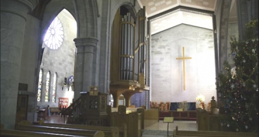
The actual name of the Cathedral is Christ Church Cathedral, The original Cathedral was a parish church – Christ Church.
Services have been held on Church Hill or Piki Mai,since 1842.
In 1859 Queen Victoria created the Diocese of Nelson by Royal Charter. As a result Nelson became a city. The Church and the city have maintained a close relationship to the present day.
From 1859 to 1889 Christ Church was the unofficial Cathedral of the Diocese. In 1889 that church was enlarged and opened as the Cathedral Church of the Diocese of Nelson.
For nearly 180 years there has been a church of sorts on the same site. The current cathedral is the fifth structure to house services on church hill, a former pa site known as Piki mai, which roughly translates as “come hither, up here”. To date none of these churches have been completed as originally designed.
By 1916 the cathedral was in a poor state of repair and the spire and tower were removed. A fire did further damage in 1920 and it was decided that a new cathedral was needed.
Frank Peck was commissioned to design the new cathedral. Another Nelson architectural firm, Houlker and Duke, provided a design for the cathedral but theirs was not successful.
Peck was an English architect from Lincolnshire and who was trained by Sir Aston Webb. He emigrated to Nelson in 1915 where we prepared designs for a number of churches, including Wellington’s St Paul’s pro-Cathedral (the design for which received praise by his former employer Sir Aston Webb and Sir Gilbert Scott, but were not built) and St Marks Church near the Basin Reserve in Wellington, Alexandra Homes in Palmerston North and Nelson and the Presbyterian church in Motueka. He also designed 5 Ronaki Terrace, near Nelson College, a fine Arts and Crafts house.
The design of the cathedral was magnificent. Also in the Early English style, the foundation stone was laid on 5 August 1925. The cathedral was to have a cruciform plan, like Thatcher’s but of reinforced concrete lined with Takaka marble. The drawings show the south elevation with a tall, steeply pitched gable including a rose window, tourelles and gabled buttresses. Under the rose window are triple gables, the central gable being the main entrance with engaged columns, hood moulds (also called label stops) with masques representing the King, Bishops Selwyn and Patterson and Archbishop Averill, and gargoyles at the junctions of the gables. The entrance doors have shouldered arches with further masques as corbels representing Bishops Hobhouse, Sadlier, Suter and Mules.
The transepts were to be of the same height as the nave and also have a rose window, tourelles, stepped buttresses quadruple lancet arched windows. A lofty octagonal spire with small and large lucarnes at the crossing was to be supported by a square planned tower with gables to each elevation, presumably to house bells, octagonal tourelles and double arched, louvred openings. The chancel was to have a polygonal apse, more flying buttresses with gablets, and a semi-circular vestry to the east and a semicircular morning chapel to the west both with conical roofs. It would have been a truly beath-taking building worthy of the site.
However, the cost of the building, the lack of trained stone masons, the Depression and the additional strength requirements for buildings after the 1931 Napier earthquake saw the building stop at the nave but without the soaring roof. Instead the walls were completed up to the beginning of the triforium level and a nearly flat roof installed over the nave, with just the steeply sloping timber ceiling of the aisles completed.
The interior elements that were completed include large round columns in the nave with stepped capitals supporting an arcade along the nave and arches over the aisles. Alternate columns have dog tooth decoration, and this from of decoration can also be seen in the mouldings over the main door. There are corbels at the junction of the arches, decorated with leaves. There are pairs of engaged columns at each end of the nave.
All work stopped in 1932 and the partially completed building was opened by Governor-General Lord Bledisloe in 1933.
The Mountfort timber chancel was added to the north end of the incomplete church.
Following the end of WWII it was decided to complete the cathedral but not to Peck’s design. A Wellington architect, Ron Muston, a partner with Structon, was selected to design the new extension. Muston trained at the Auckland Architecture School and established his own firm in 1939 in Wellington. He became a partner in Structon an architectural practice in Lower Hutt where he designed a number the civic building as well as St James church in 1953 for which he won a gold medal from the NZIA. This church was a remarkable Modern Movement design with stepped, rectangular forms, large areas of glass and a starkly simple, off centre, bell tower facing the street.
Muston followed the general floor plan that Peck had designed but with rectangular transepts, chancel, vestry and chapel on opposite sides. Choir rooms, kitchen, offices and toilets. are located in the same location as the polygonal apse. Instead of Takaka marble, reinforced concrete coloured to look like marble was used. The tower was located in the centre of the elevation, unlike St James, and unlike either the Modern Movement or the Gothic style.
The original design mirrored St James Lower Hutt as a simple, Modern Movement design, with a similar tower to St James but in the centre of the north elevation. The vestries, chapel and robing room are clearly articulated rectangular forms. The Modern Movement design was not acceptable. It had to be Gothicised, and who better to redesign the openings (everything else remained the same) but Ian (later Sir) Athfield who was working at Structon at the time. He found the exercise somewhat frustrating which is understandable given his post-modern sensibilities revealed in his extensive portfolio of later work.
Some of the rectangular windows became simple lancets and the tower was Gothicised with shallow arched mouldings, similar to Early English Gothic, and simple tracery. The roofs of these lower spaces are flat with the nave transept roofs nearly flat. A nearly flat roof in a Gothic church is typical of Perpendicular Gothic which does not sit well with the Early English style of Peck’s original. The ceilings are lined with pink or white acoustic tiles with leaf and fleur-de-lis patterns.
The completed building was opened by Governor-General, Sir Bernard Fergusson, in 1967. At the time the Nelson press was not happy with the compromised design suggesting that the church was settling for second best.
Other changes have happened since the cathedral was opened. The narthex was redesigned, a new organ case and stand were installed, and the chapel now has stained glass windows.
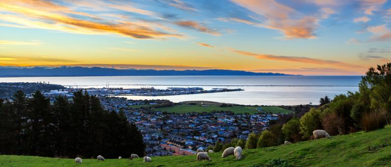
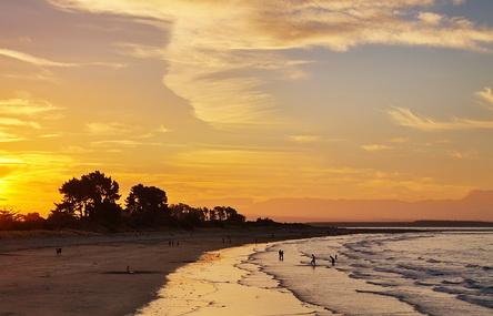
Tāhunanui is one of the suburbs of Nelson, New Zealand. It lies between Port Nelson and Nelson Airport and is the site of the main beach for Nelson with a shoreline on the Tasman Bay / Te Tai-o-Aorere.
The New Zealand Ministry for Culture and Heritage gives a translation of "large sandbank" for Tāhunanui. Tāhunanui has several local parks: Annesbrook Youth Park, Bolt Reserve, Burrell Park, Centennial Park, Paddys Knob Reserve, Tāhunanui Recreation Reserve, Tasman Heights Reserve and Tosswill Reserve.
There is also an Airport Peninsula Esplanade on the way into Nelson Airport.
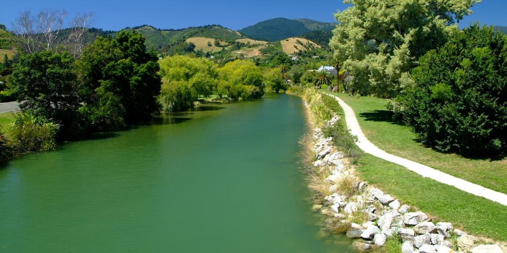
Maitai River Walkway runs alongside Maitai River through central Nelson. The walkway begins at the Maitai River mouth and extends for eight kilometres to Maitai Motor Camp in the Maitai Valley, passing through a mixture of urban and natural surroundings along the way. The walkway is a great option in summer as there are many swimming holes and picnic spots to stop at. The river’s name is a corruption of ‘Maitahi’, which refers to a particular mataī tree that grew on one of its banks.
Maitai River Walkway can be accessed at numerous locations in the central city. The river mouth end connects directly to Haven Road Shared Pathway (which heads to Wakefield Quay) and Atawhai Shared Pathway (which follows QEII Drive to Atawhai). Good starting points for walks are Millers Acre and Riverside Pool. The walkway can be completed as an out-and-back trip, or you can combine it with other tracks to create a longer circuit (Botanical Hill and Tantragee Saddle are good options). At the upstream end of the walkway there are car parks on each respective side of the Maitai Motor Camp. Most of the walkway is open to both walkers and cyclists, though as it is busy and narrow in sections, cyclists need to be respectful and courteous towards people on foot.
Beginning at the Maitai River mouth where QEII Drive bridge crosses, the walkway begins as a wide promenade alongside Rutherford Park, with terraces stepping down to the river. The walkway crosses Trafalgar St, passes Nelson Visitor Information Centre at Millers Acre, then goes beneath the Collingwood St Bridge to Riverside Pool, where there is a footbridge across to Halifax St East.
Beyond Riverside the walkway goes beneath Bridge St and runs parallel with Domett St to Hardy St, where there is a pedestrian bridge crossing the river to Hardy St East (giving quick access to Botanical Hill).
Beyond Nile St the walkway is unsealed, and undulates on the bank adjacent to Girlies swimming hole, named because it was used by Nelson College for Girls for swimming sports. No bikes are allowed along this section. The walkway follows the bend in the river and goes beneath Nile St again (Clouston Bridge), then through Hanby Park, where a boardwalk sidles the rock face above Black swimming hole. The walkway goes beneath Maitai Valley Rd at Jickells Bridge and weaves between native plantings past Dennes swimming hole around the Maitai Cricket Ground, before reaching the Maitai Valley Rd again at Gibbs Bridge. After Sunday swimming hole the it crosses pasture, then runs alongside Waahi Taakaro Golf Course and then Maitai Arboretum, across the river from the Maitai Motor Camp (where Maitai Camp swimming hole is located). At the end of the walkway a footbridge crosses the river to Maitai Valley Rd, where there is a small car park.
To create a circuit with Tantragee Saddle and Brook Valley, you can cross the fence stile at the footbridge and continue along the track that climbs steadily through Tantragee Arboretum (you can also backtrack a few hundred metres to Te Ara Kōpiko which begins adjacent to the motor camp). It’s about 2.2 km to Tantragee Saddle, and once at the top you have several options for descending into Brook Valley and reconnecting with Maitai River Walkway.
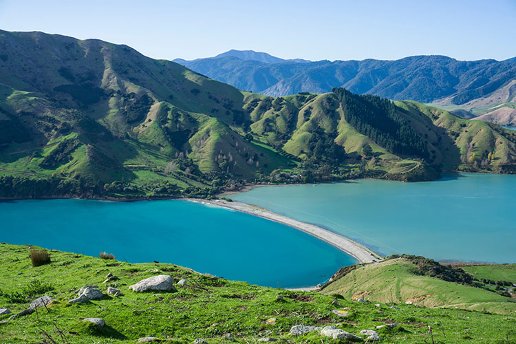
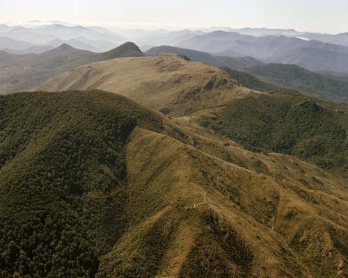
Dun Mountain (1129 m) is located on the Bryant Range, southeast of central Nelson. It is the namesake of the popular Coppermine Trail, as well as the Dun Mountain Mineral Belt and dunite, the ultramafic rock which the latter largely comprises. A return trip to the summit is a full-day walk from Maitai Dam, typically via a circuit combining Coppermine Trail and Rush Pool Track.
Dun Mountain is accessed from the end of Maitai Valley, which is 11 km up Maitai Valley Road from central Nelson. Use the car park just after Maungatapu Road turnoff, or if the gate is open, continue to the car park on the other side of the dam spillway. Take note of the signage that warns the gate will be closed at 5 PM.
You can climb to the summit via either of two tracks; Coppermine Trail or Rush Pool Track. Coppermine Trail is by far the more popular of the two and is less arduous, though as they both start at Maitai Dam and are roughly the same length, it’s a good idea to create a circuit out of both.
The majority of the circuit is within Nelson City Council’s Maitai Water Reserve. Along the top of Bryant Range between the Dew Lakes junction and Dun Saddle, the track skirts back and forth across the Mt Richmond Forest Park boundary, which roughly follows the top of the range.
This circuit can be completed in either direction.
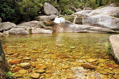
From the dam car park, head along the gravel road on the other side of the gate, which climbs steadily through a block of recently-felled pine forest before gaining the top of a spur. Here, Rush Pool Track branches off to the right and continues through mineral belt scrub to the Rush Pool and a historic Maori argillite quarry. The Rush Pool was created by Maori in the 16th century to help quarry argillite. The quarrying process involved lighting a fire beneath rock outcrops to heat them, then dousing the rock with cold water from the pool, causing shards to split and crack off. A return trip to the Rush Pool alone will take you around 2 hr 30 min.
The track continues uphill, alternating between beech forest and mineral belt scrub. It is very rutted in places, and at times is literally a creek bed. You will reach a T-junction with Dun Saddle-Maungatapu Saddle Track at the top of Bryant Range (940 m elevation) after 2-3 hours. Turn right (south) at the junction to continue toward Dun Mountain. Dew Lakes are located 1 min north of the junction (to the left).
The top of the range is forested and flat, though quite boggy in places. The track climbs steeply over Little Twin (1143 m) before dropping down into a saddle. The stark boundary between beech forest and scrub at the saddle marks the beginning of the mineral belt. From here the track climbs up onto the Dun Mountain summit ridge to the summit (1129 m) which is marked by a cairn. Enjoy the magnificent views along Bryant Range and out to Tasman Bay.
Continue along the summit ridge (you will pass Dun Mountain shelter) and drop steeply down to Dun Saddle (930 m). Turn right and follow the rocky track on the right side of the gully. After 800 m you’ll reach the connection with Coppermine Trail. It is downhill for the remainder of the distance to Maitai Dam. Be wary of MTBs that may approach quickly from behind (though they should be the ones looking out for you). The track descends the western flank of Dun Mountain, then zig-zags into the valley of Maitai River South Branch. Once you cross the bridge across the river, it’s an easy 3.3 km back to where you started at Maitai Dam.
Grampians are a group of hills rising steeply behind central Nelson. Named after the mountain range in Scotland, the tallest point reaches 390 m and is notable for having a TV transmission tower on top. Grampians are dissected by a network of tracks which are popular among walkers and runners given their proximity to the city.
Grampians tracks can be accessed from multiple locations around the base of the hills, though the three main access points are Upper Collingwood Street, Market Road in Bishopdale and Blick Terrace in Brook Valley.
High fire risk in summer will close access.
All Grampians tracks are suitable for walking and trail running. Nelson City Council allows MTB on every track except Kahikatea Track, though bikers are seldom seen. It is fair to say the tracks are best enjoyed on foot, particularly given the volume of people on them, their narrowness, and the fact that MTB-specific Codgers MTB Park is only a short distance away.
Grampians are contained within 161 ha of Nelson City Council reserve land and are home to a diverse range of vegetation, including exotic woodland, pine plantation, regenerating native, and some original native. The mix of vegetation provides an attractive backdrop behind the central city and creates interesting transitions along the tracks, several of which are named after the native tree variety that can be found along their length; Kahikatea, Kānuka, Mahoe, Mamaku and Tawa.
These tracks give access to some of the best vantage points for views over the city, and further out across Tasman Bay. The tracks on Grampians vary in their physical difficulty, from tough, steep ‘grinds’, to relatively gentle strolls. Every track on Grampians includes a certain degree of uphill, though the physical challenge provides part of the appeal. They can be combined in numerous ways to form loops of varying length and difficulty to suit most abilities.
Since 2009, the community group Birdlife on Grampians have run a trapping programme which has reinvigorated native birdlife. Thanks to these efforts you’re more likely to enjoy the increasing numbers of species like kererū, tui and weka.
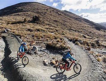
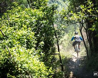
Coppermine Trail is one of the must-do rides in Nelson. The trail follows the alignment of the historic Dun Mountain Railway, New Zealand’s first railway, which was in operation between 1862 and 1901 to transport chromite extracted from mines on the eastern slopes of Wooded Peak. The trail ventures through the dramatic landscape of the Dun Mountain Mineral Belt, which is characterised by stunted vegetation and reddish-brown ultramafic rocks. It has become a popular mountain-biking circuit and is included as one of New Zealand’s Great Rides. Its appeal stems from the fascinating landscape it traverses, as well as its achievable length and ability to be completed from central Nelson. Coppermine Trail also provides access to Rocks Hut and Te Araroa Trail, and passes through the trail riding areas of Codgers MTB Park and Fringed Hill.
Follow Tantragee Road from either one of the car parks (in Brook Valley or Maitai Valley) to Tantragee Saddle, and at the top turn onto Fringed Hill Road, which continues uphill (you will see Nelson City Council signposts directing you).
The road climbs in up and around Groom Creek gully, and then around the northern aspect of Fringed Hill, before switching back westward for the final climb. The average gradient of Fringed Hill Road is 11% and is reasonably consistent the whole way up. The hillside is covered in young pine trees which are low enough to allow amazing views north and west across Tasman Bay. The road rounds the upper slopes of Groom Creek gully again, before reaching the top of the unnamed spur that forms the western side of the gully. The road forks here.
To access the summit, turn left at the fork, (it is signposted) and continue up a couple more zig-zags. The summit hosts transmission masts and associated buildings, and there is a trig and a couple of wooden benches to relax on after your climb. Beech forest begins immediately behind the buildings, and a signs indicate the respective beginnings of Black Diamond Ridge (expert difficulty) and Te Ara Koa (advanced difficulty).
Instead of climbing to the summit, heading straight at the fork will take you to a clearing where Fringed Downhill (expert difficulty) descends down Bullock Spur into Brook Valley. Continue straight to head onto Fringed Hill Classic, which descends Cummins Spur through native bush and pine forest, and intersects Coppermine Trail at Four Corners.
The walk to Maitai Cave begins at Maitai Dam, which is 11 km up Maitai Valley from central Nelson. You can use the first car park just after the Maungatapu Track turnoff, or the second car park a few hundred metres further, on the other side of the dam spillway (note that the gate is closed to the latter car park at 5 pm). Maitai Cave Track forks off Coppermine Trail, which is accessed via the pedestrian bridge between the two car parks.
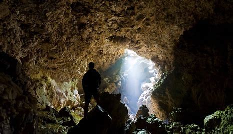
Cross the pedestrian bridge and follow Coppermine Trail. The first 2 km passes through kānuka on the true left of Maitai River South Branch, then enters original native forest. The turnoff to the cave is 3.6 km from the car park, just before the bridge across Maitai River South Branch. After leaving Coppermine Trail, Maitai Cave Track crosses Sclanders Creek (not bridged), which is named after David Sclander, an early Nelson settler involved in the mining of Dun Mountain. The track grade is a step down from the well-maintained Coppermine Trail, and you will have to negotiate a few roots, logs and muddy patches. The track follows a natural embankment between Sclanders Creek and Maitai River South Branch, skirting the western fringe of the mineral belt before entering stunning beech-podocarp forest that features rimu, kahikatea and mataī, with Sclanders Creek flowing on the right. This area is known as Cawthron Park, a 1,000 ha piece of bush gifted to the city by Thomas Cawthron in 1913. This is one acts of the many acts of philanthropy by Cawthron, who was also the founder of Cawthron Institute. The gradient steepens a little in the final few hundred metres to the cave. The cave entrance is a narrow opening on the hillside, guarded by limestone outcrops. If you want to explore the cave, make sure you have a headlight torch and some clothes that you don’t mind getting muddy. Allow 20 minutes for exploration. Remember that the inside of the cave is a delicate environment that has taken thousands of years to form. Do not remove anything from the cave and be sure not to leave any waste behind. Return the way you came.
This circuit can be completed in either direction; though the description below describes taking Rush Pool Track on the uphill leg, Maungatapu Track is steeper and may in fact be preferable for some people to climb up rather than come down. From the dam car park, head along the gravel road on the other side of the gate, which climbs steadily through a block of recently-felled pine forest before gaining the top of a spur. Here, Rush Pool Track branches off to the right and continues through mineral belt scrub to the Rush Pool and a historic Maori argillite quarry. The Rush Pool was created by Maori in the 16th century to help quarry argillite. The quarrying process involved lighting a fire beneath rock outcrops to heat them, then dousing the rock with cold water from the pool, causing shards to split and crack off. A return trip to the Rush Pool alone will take you around 2 hr 30 min. The track continues uphill, alternating between beech forest and mineral belt scrub. It is very rutted in places, and at times is literally a creek bed. You will reach a junction with Dun Saddle-Maungatapu Saddle Track at the top of Bryant Range (940 m elevation) after 2-3 hours. Turn left (north) here to continue toward Maungatapu Saddle. Dew Lakes are a short distance from the junction. While their name is somewhat misleading (‘ponds’ would be a more appropriate title), they provide a convenient place to stop for a lunch break. The track then climbs over the highest point of the circuit, Maungatapu summit (1014 m). A rocky outcrop opens among the trees and allows views across the upper Maitai catchment. The track descends from Maungatapu into a saddle and climbs again along the range through beech forest, and then descends to Maungatapu Saddle. From here it is an easy walk back down Maungatapu Track, which is a wide 4WD road all the way back to the junction next to the caretaker’s house; here you can continue straight along the road that drops down to the dam crest and leads back to both car parks. From Maungatapu Saddle you can also continue along the ridge on Saddle Hill Route (the Doubles), which climbs to the South Double (1168 m). While the distance is only 2 km, the climb is steep and challenging; allow at least an 1 hr 30 min to reach the summit.
From Brook St, the gravel road heads up a gully towards the Nelson City Council water treatment plant. Codgers Track (Dun Mountain Trail) connects on the left just after the treatment plant. The road cuts back above the plant, and Dun Mountain Trail continues on the right. At the saddle (180 m elevation) there is an intersection between Tantragee Rd, Fireball Rd (access to upper Codgers tracks) and Fringed Hill Rd. Te Ara Kōpiko also starts at the saddle, which you can take as an alternative to the road (note that you can only ride it in the uphill direction). The road descends into Groom Creek gully, passing water treatment ponds and then forks. Here you can either head right and pass through the arboretum to reach the end of Maitai River Walkway, where there is a pedestrian bridge across Maitai River. Heading straight will connect you to Maitai River Walkway immediately down-valley of Maitai Motor Camp, where there is a road bridge across Maitai River to Maitai Valley Rd. A circuit down Maitai River Walkway and up Brook St back to where you started is approximately 11.5 km. There are numerous other tracks that can be taken to shorten or lengthen your route.
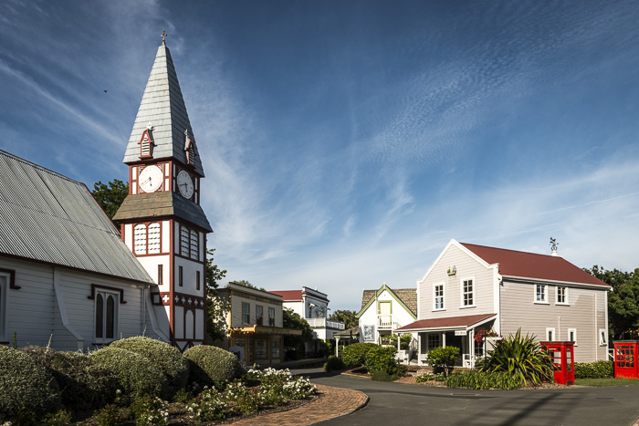
Bring the family to spend a lovely afternoon walking through a village of character buildings which are set in beautiful well established gardens. Explore displays of Nelson’s heritage, learn the stories of our local people and meet our working artisans. While visiting, we have an array of activities for the whole family! Enjoy the experience of a railway that has all the flavour of the Nelson to Glenhope line. The Nelson Railway Society, formerly the Grand Tapawera Railroad Co., began in the late 1980s. It intended setting up a working railway at Kohatu using the old existing railway formations, but in 1991 the decision was made to move to Founders Heritage Park. We have a gift shop on site, that provides A selection of books from the Founders Book Fair is available throughout the year, as well as handmade art, gifts and crafts. Take a gentle stroll around our mature gardens, relax with a picnic on the Village Green or enjoy the bird life on the lake. A visit to the park isn’t complete without relaxing in the leafy courtyard of Founders Café whilst the children enjoy the adjacent playground. Savour the taste of Nelson including locally brewed craft beers and premium Nelson wines which makes the café a perfect place for lunch.
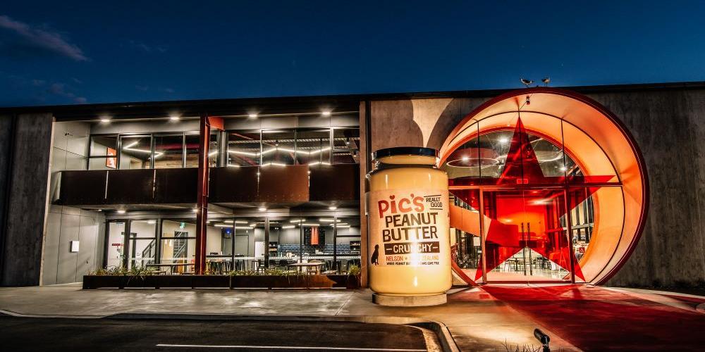
Welcome one and all to Pic’s Peanut Butter World, the home of all things Pic’s Peanut Butter! Peanut Butter World isn’t just where we make our Really Good award-winning products, but a specially designed space that allows us to host tens of thousands of Peanut Butter lovers every year. Our world-famous Peanut Butter World tours have been designed so young and old, as well as people of all mobilities can share in the wonder of how we make NZ’s most loved peanut butter.
Tours will be a little different from what we're used to, they're smaller, a bit faster, but just as fun! We are a vaccination certificate venue and vaccination passes will need to be sighted before entry. So please be kind to our fab bunch of Peanut Butter Makers and follow all guidelines when you're popping in to visit Peanut Butter World. Our dynamic trio of tremendous tour guides, Rosey, Rachel and Claudia are on hand to show you around and share our stories. Our tours are a delight for the senses, see it being made, and smell the peanuts being freshly roasted. Complete your visit with a trip to our dedicated Peanut Butter store and a coffee from The PC Eatery which opens Monday to Friday.
Bookings for these tours are compulsory and FREE!